A majestic waterfall is one of Mother Nature’s most beautiful creations. Whether it cascades with rushing water during the spring runoff or is a frozen blue hue, seeing a fall up close brings a sense of peace.
Videos by Outdoors
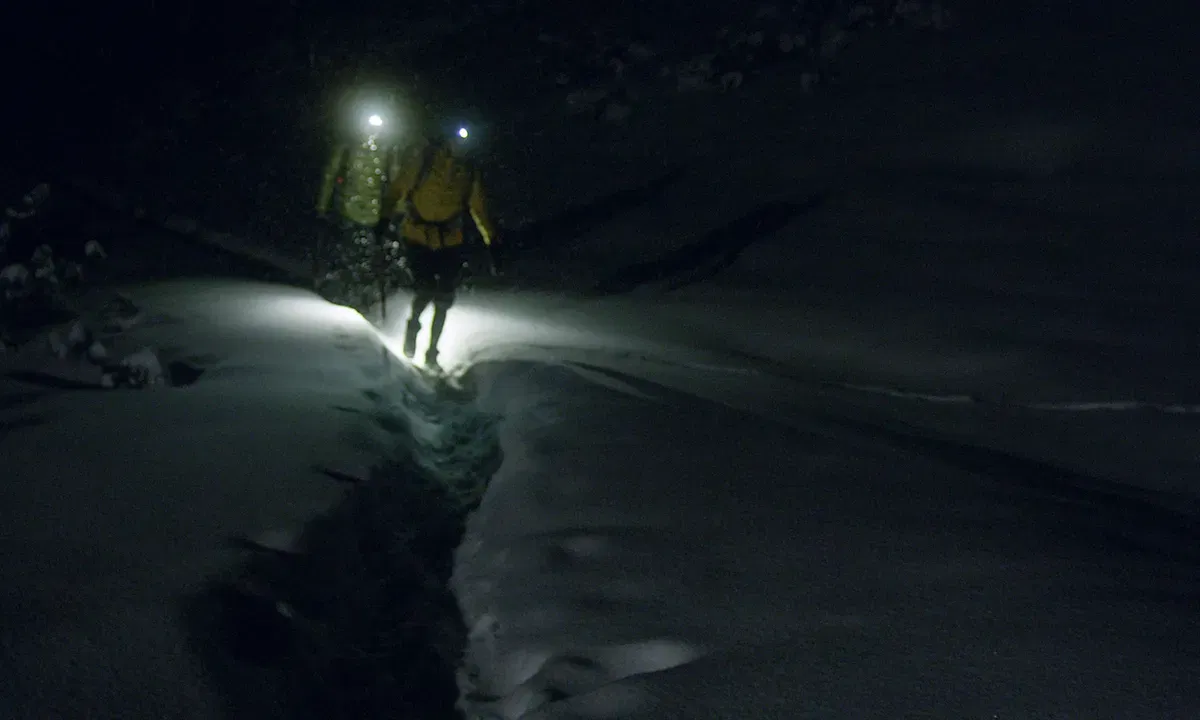
If you’re planning a winter hike to a frozen waterfall, be sure to check the weather forecast. It’s also important to remember that in the cold and snow, hikes will take longer than in warmer, dry conditions: You can expect to cover half the distance you usually cover in the same amount of time during the warmer months.
These 10 falls freeze up starting the end of fall through early to mid spring and are surely worth the hike, no matter what time of year you head out to enjoy them.
1. Alberta Falls, Rocky Mountain National Park

Trail length: 1.6 miles roundtrip
Time: 1 to 1.5 hours
Difficulty: Easy
What to expect: This out-and-back hike is rated easy with only 225 feet of elevation change. When this 30-foot-high fall is frozen, you may still be able to view flowing water behind the ice of the frozen falls, unless fresh snowfall on the ice obscures the view. Check local conditions at the park because the weather may close the park roads and trails. December to March is the best time to view these frozen falls.
How to get there: Located about an hour and 20 minutes outside of Boulder, the hike begins from the Glacier Gorge Trailhead; a free parking shuttle is available during peak visitor seasons.
Fees: National Parks Pass ($80) or $30 vehicle entrance pass
Pets allowed: No; pets aren’t allowed on any of the trails at Rocky Mountain National Park.
2. Cascade Creek Trail, San Juan National Forest

Trail length: 8.1 miles one way
Time: 3.5 to 4 hours
Difficulty: Moderate
What to expect: This is one of the lesser-traveled winter trails, and the distance and elevation gain of 1,500 feet make this better for experienced winter sports enthusiasts and snowshoes. This canyon is also an ice climbers’ paradise, so expect to see some climbers on one of the many frozen waterfalls you can view. Check trail conditions before heading out. December through February is the best time frame to snowshoe this trail.
How to get there: Located in the southwest corner of Colorado, the trailhead near Durango is the more common starting point.
Fees: None
Pets allowed: Yes, on leash
3. Fish Creek Falls, Steamboat Springs

Where: Steamboat Springs, CO
Trail length: 0.5 miles roundtrip to the base of Fish Creek Falls, 5 miles roundtrip to Fish Creek Upper Falls
Time: 30 minutes to 2.5 hours
Difficulty: Easy to base, challenging to the upper falls
What to expect: The 283-foot Fish Creek Falls is frozen from December to April. The hike to the base of the falls is typically hard-packed due to frequent use throughout the winter. Past the lower falls to Fish Creek Upper Falls, the trail becomes more challenging and steep. Snowshoes or spikes are recommended on this hike during the winter. Snow banks often rise over two feet in places on the sides of the trail. Enjoy this hike early in the morning for more solitude and a chance to grab a coveted parking spot. Check local conditions before heading to this trail. Weather-related closures, including avalanche risk, can close this trail.
How to get there: In the north-central part of the state, Fish Creek Falls is just outside of Steamboat Springs, Colorado.
Fees: Day use fee of $5 (cash and check only) or display National Parks Pass or Golden Passport
Pets allowed: Yes, on leash
4. Hanging Lake, White River National Forest

Trail length: 2.4 miles roundtrip
Time: 2.5 to 3 hours
Difficulty: Hard
What to expect: Hanging Lake is a National Natural Landmark bringing droves of visitors. While summer is the most popular time to hike this trail, more people are discovering the beauty of the falls in the winter. This trail is rated “hard” in the winter because it climbs over 1,000 feet from the Colorado River to the lake. Expect snow and icy conditions from October thru May. Ice spikes are necessary, especially for the climb up and back down. You’ll also need to purchase a permit ahead of time to hike this trail. Weather-related closures apply, so check the status before heading out to hike.
How to get there: Hanging Lake in Glenwood, Colorado, is located 2.5 hours due west of Denver
Fees: $10 per person per permit
Pets allowed: No
5. Helen Hunt Falls, Colorado Springs

Trail length: 0.75 miles roundtrip; 1.5 miles, if you add Silver Cascade Falls
Time: 1 to 2 hours
Difficulty: Moderate
What to expect: While you can view the 35-foot falls from the parking lot, if you’re able, the climb up the 100 steps built into the mountainside offers a closer and even more incredible view of the falls. It can sometimes be steep and icy, so plan to wear traction, but snowshoes are not recommended because of the steps. If your legs allow, you may choose to continue onto Silver Cascade Falls, on a steep trail that climbs another 200 feet. The best time to view the frozen falls is between December and March. Check road and park closures before you go.
How to get there: The falls are located in North Cheyenne Cañon Park in the southwest outskirts of Colorado Springs, about an hour and 20 minutes due south of Denver.
Fees: None
Pets allowed: Yes, on leash
6. St. Mary’s Falls, Colorado Springs

Trail length: 6.5 miles roundtrip
Time: 2.5 to 3.5 hours
Difficulty: Moderate
What to expect: Over this 6.5-mile out and back, there’s about 1,500 feet of elevation gain. The trail follows Buffalo Canyon Creek speckled with small frozen sculptures before you reach the impressive frozen 300-foot St. Mary’s Falls. The hike starts off crowded and packed down on Gold Camp Road, but it gets more secluded and difficult as you wind through the forest and climb to the falls. The best time to hike this trail is from December to March. Check road and park closures before you go.
How to get there: Also located in North Cheyenne Cañon Park, it’s about 17 miles and an hour or so to drive between Helen Hunt Falls and St. Mary’s Falls—and the same 2-plus hours to drive there from Denver.
Fees: No fees
Pets allowed: Yes, on leash
7. Horsetooth Falls Loop Trail, Fort Collins

Trail length: 3.2 miles roundtrip
Time: 1.5 to 2 hours
Difficulty: Easy to moderate
What to expect: This loop hike offers views of the best of Horsetooth Mountain Open Space. Follow the purple loop signs to the falls, and check out the view of the upper falls before continuing the loop back to the trailhead. In total, there’s 800 feet of elevation gain on this hike. Parking is limited and fills up early, especially on the weekends. Check this trail conditions for winter and spring trail closures.
How to get there: Located in north-central Colorado, the trailhead is 30 minutes from the center of Fort Collins and about an hour and 20 minutes due north of Denver.
Fees: $10 per vehicle
Pets allowed: Yes, on leash
8. Maxwell Falls, Evergreen, CO

Trail length: 3 miles roundtrip
Time: 1.5 to 2 hours
Difficulty: Moderate
What to expect: There are two ways to tackle this lollipop loop on the Upper Maxwell Falls Trail. Most people prefer going clockwise, so you can enjoy the falls in the later part of the hike. You can also begin your hike at the Lower Maxwell Falls Trailhead, which adds an additional mile to your hike. These falls aren’t as majestic as some, but you can climb up and get a closer look at them than some others. Don’t forget to check for road closures before you go, especially in winter.
How to get there: The trailhead for the Upper Falls is located under an hour southwest of Denver.
Fees: None
Pets allowed: Yes, on leash
9. Rifle Falls, Garfield County, CO
Trail length: 0.2 miles on a paved path
Time: 30 minutes
Difficulty: Easy
What to expect: This 80-foot triple waterfall is quite the site to see in the winter. The paved path is typically packed down, but ice is common on the short flat trail, so watch your step. After you marvel at mother nature’s work, continue beyond the waterfall to some caves. Have a headlamp or flashlight for this adventure as the spaces are void of light. No matter the time of year, a visit to the falls is on many visitors’ bucket lists, so arrive early for fewer crowds. Check out park conditions before heading to visit the falls.
How to get there: It’s a 3-hour, 15-minute drive west from Denver to Rifle Falls State Park.
Fees: $10 daily vehicle pass, $80 Colorado State Parks Pass
Pets allowed: Yes, on leash
10. Rifle Ice Caves, Garfield County, CO

Trail length: 1 mile roundtrip
Time: 1 hour
Difficulty: Easy to moderate
What to expect: Make a day out of your visit to Rifle with a visit to the Ice Caves, which are about as close to a non-CGI version of Elsa’s castle you’ll find. While the trail hike on the Koper’s Trail to the upper and lower caves is easy, the trails through the caves are off-camber and can be slick and require traction. Expect to share the trail with ice climbers who are often spotted climbing ice within the park. Don’t rush your visit to this natural wonder. Parking is limited, and you may have to park and walk to the trailhead. December to February is the ideal time to see the frozen caves.
How to get there: It’s about a 10-minute drive from the Rifle Falls trailhead to Koper’s Trail in Rifle Mountain Park.
Fees: $5 daily use fee
Pets allowed: Yes